Quick summary
- Hike about 3 km each way to the crater, then ride the lift 120 meters down into a drained magma chamber.[1][2]
- Mineral deposits left by the last eruption paint the chamber walls in vivid colours, from deep reds to golds.[2]
- You cannot visit independently; the guided hike or a helicopter are the only ways to the volcano base.[1]
- The tour runs from May 5th to October 30th, and pickup from Reykjavik is available.[1][3]
- Rated 4.85 from 630 reviews, with a live guide in English and Icelandic and free cancellation up to 24 hours before.[3]
- Top choice Thrihnukagigur Day Trip from US$432 Duration4 - 6 hours[3]Rating4.85 from 630 reviews[3]Guide languageEnglish, Icelandic[3]CancellationFree up to 24 hours[3] Check availability
- Eruption Site & Reykjanes from US$132 Duration9 hours[4]Rating4.65 from 1,154 reviews[4]Guide languageEnglish[4]CancellationFree up to 24 hours[4] See this tour
- Raufarhólshellir Lava Tunnel from US$153 Duration3 hours[5]Rating4.59 from 850 reviews[5]Guide languageEnglish[5]CancellationFree up to 24 hours[5] See this tour
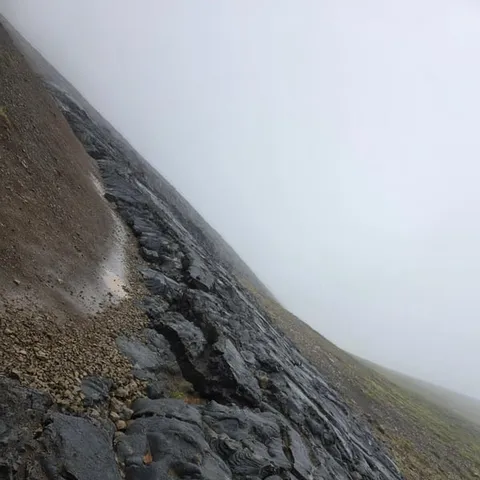
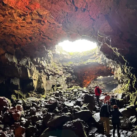
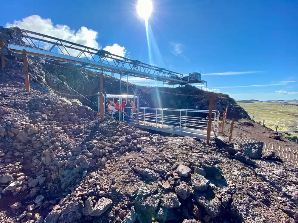
The 120-meter (400 feet) journey to the center of the earth takes about 6 minutes.
A one-of-a-kind descent into a sleeping volcano
Good to know
Why Iceland exists at all
Iceland is an island built by fire. It sits on the Mid-Atlantic Ridge, where the North American and Eurasian plates are moving apart, and it also happens to sit above a mantle plume that feeds extra magma to the surface. The island lies at the meeting point of two tectonic plates, with the rift crossing the country from the southwest to the northeast. The result is a landscape that is still being made: new basalt, fresh craters and steaming geothermal fields appear wherever the crust stretches thin.
Most visitors meet this geology through the places they can touch. Waterfalls, black sand beaches, hot springs and glacier lagoons all owe their existence to volcanic activity. The island is a working example of how the planet recycles its crust, and every eruption is a reminder that the process has not stopped.
For a traveller, the appeal goes beyond scenery. Knowing that the ground beneath you is geologically alive changes the way you read the landscape, from the flat-topped mountains to the mossy lava fields. Thrihnukagigur takes that curiosity one step further: it lets you stand inside the source.
Where the activity actually is
Much of Iceland's recent volcanic activity has been concentrated on the Reykjanes Peninsula, southwest of Reykjavik. The peninsula sits directly on the rift, and its surface is a patchwork of lava fields, geothermal areas and crater rows. Thrihnukagigur lies within this volcanic landscape, in the Bláfjöll area. The meeting point is a ski cabin in Bláfjöll, about a 30-minute drive from Reykjavik on paved road.[7] The mountains here are a local playground, popular for skiing in winter and hiking in summer, which makes the drive straightforward.
The location makes the volcano a practical escape from the city. The tour starts with pickup in Reykjavik, continues by bus/coach to Thrihnukagigur, and returns to one of 28 drop-off locations.[3] Along the way you pass dark lava, bright moss and mountains that shift colour with the weather, a reminder of how young this land really is.
If you want a thrihnukagigur volcano tour Iceland can deliver reliably, the guided hiking day trip from Reykjavik is the one that gets you inside. Other itineraries take you to eruption sites or lava tunnels, but this is the experience that goes below the surface into the chamber itself.
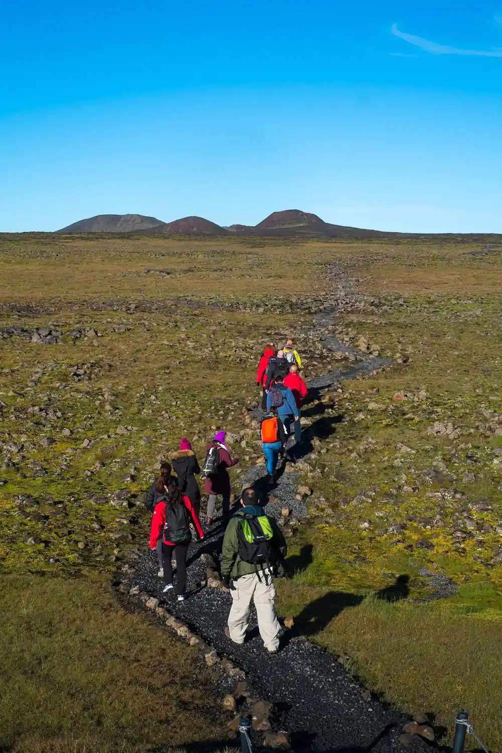
Walkers cross the mossy lava field on the approach to Thrihnukagigur's red cone.
The eruptions in the news
In recent years, the Reykjanes Peninsula has been in headlines around the world. Eruptions at Fagradalsfjall and in the Geldingadalir valley drew hikers and journalists, offering long, slow lava fountains that were safe enough to watch from marked paths. For a few seasons, lava poured from fissures within easy walking distance of car parks, and the images circled the globe.
Thrihnukagigur comes from a different moment in volcanic history. It last erupted about 4,500 years ago.[8] Instead of leaving a pipe filled with cooled lava, the volcano drained its own magma chamber deep below, and that empty space has survived to the present day.
The distinction matters when you plan a trip. Eruptions in the news are unpredictable, and access can depend on wind, gas and official decisions. Thrihnukagigur is a fixed attraction, open on a schedule, operating every year from May 5th to October 30th.[1] The drama is quieter, but the experience is dependable.
Why you can enter this one and not the others
The reason you can enter this volcano is simple: the magma chamber is empty. It is believed that a deep underground rift drained the molten rock, leaving behind an enormous subterranean cavity.[8] Most volcanoes seal their conduits with cooled lava, which is why you can almost never walk inside them. Thrihnukagigur's plumbing failed in a useful way, creating a hollow vault where magma used to sit.
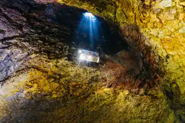
The chamber was discovered in 1974 by cave explorer Árni B. Stefánsson, and later opened for tourism.[8] A lift now carries visitors through the throat of the volcano to the floor of the vault. The main cavity is about 120 m deep, with a bottom floor measuring 50×70 m.[8]
Access is deliberately limited. You cannot visit Thrihnukagigur independently; the only ways to get to the volcano base are the guided tour hike or a helicopter tour.[1] The guided day trip is the standard choice, and the hike to the crater is an integral part of the experience. If you prefer to skip the walk, a helicopter option exists.[9]
from US$432
The Thrihnukagigur Volcano Guided Hiking Day Trip is rated 4.85 from 630 GetYourGuide reviews.[3]
Inside the chamber: what you will see
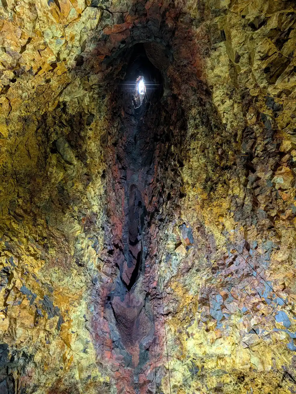
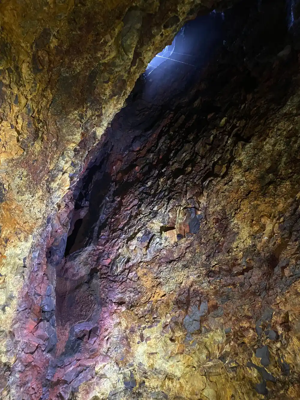
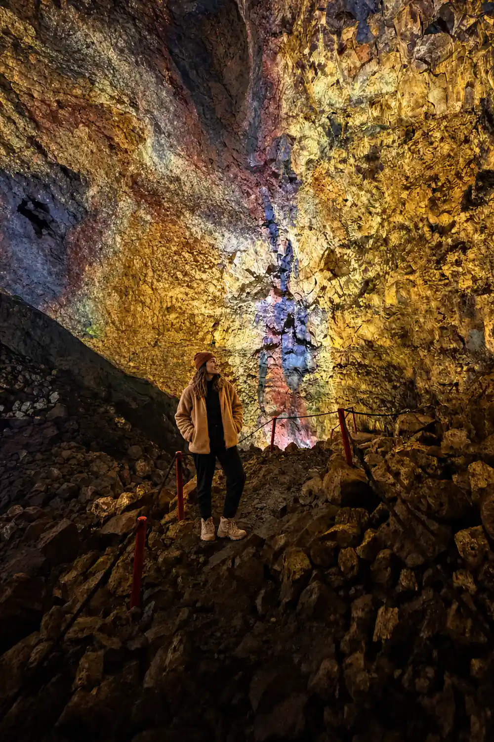
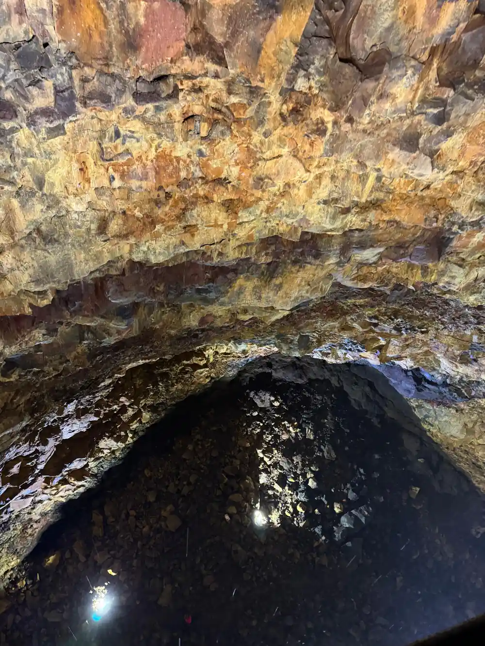
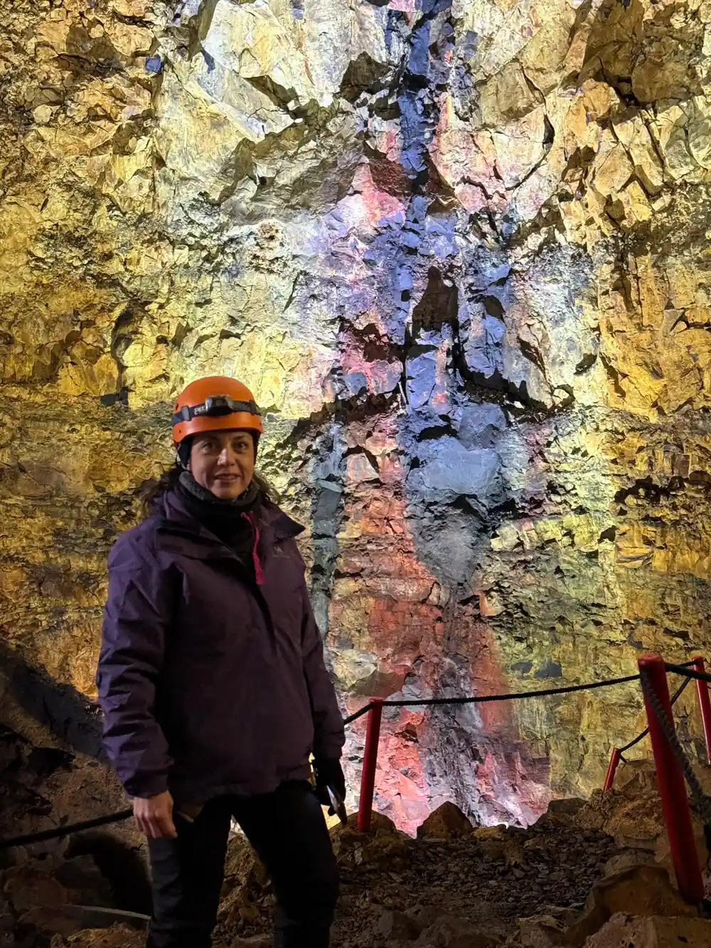
Once you are below the surface, the first impression is colour. The walls of the chamber get their hues from mineral deposits left by the last eruption.[2] In the lamplight, the rock shows bands of red, yellow, green, blue and black, like a painting that fills your whole field of view.
The second impression is size. A funnel-shaped opening at the top widens into a bottle-shaped vault, and the floor is so large that the group spreads out easily. You can walk from one end to the other and still feel small, with the opening of the crater glowing far above.
You have time to take it in. Visitors spend approximately 35-45 minutes inside the volcano, including the descent, time on the chamber floor, and the ascent.[6] With a live guide in English and Icelandic, you can ask questions, find the best corners for photos, and simply stand still in a space few people ever reach.[3]
The hike, the lift, and the time below
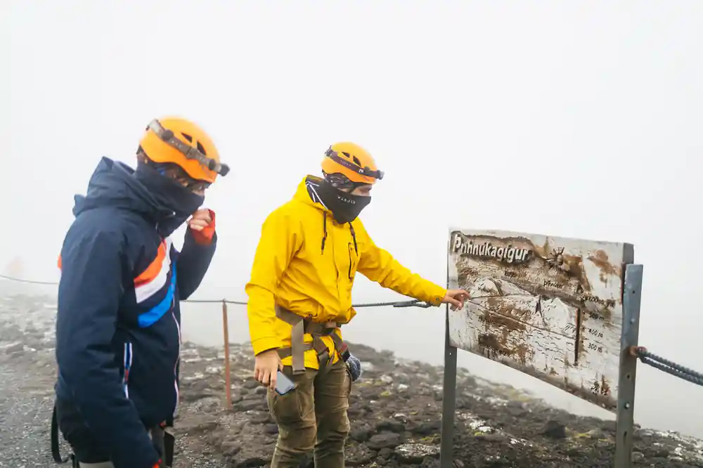
The tour is a full outdoor outing, not just a lift ride. The path to the volcano is about 3 km (2 miles) each way and usually takes about 45 minutes with your guide.[1] It crosses lava fields with gentle gradients, so you can save your energy for the descent and the walk around the chamber floor.
At the crater, the descent begins. The journey down is 120 meters (400 feet), and the lift ride takes about 6 minutes.[2] The lift drops you through the throat of the volcano, and your first step onto the chamber floor is the moment the scale becomes real.
The day trip fits into a normal Iceland itinerary. It runs 4 - 6 hours from Reykjavik, with pickup available and a live guide in English and Icelandic.[3] The minimum age is 8 years old, so older children can take part.[6] Because the tour runs from May 5th to October 30th, it slots neatly into the summer travel season.[1] If you are combining it with other sights, the length leaves room for more of your Iceland checklist.
The table mountains, if the cloud lifts
The drive to the volcano has its own rewards. On a clear day, the route from Reykjavik toward Bláfjöll passes flat-topped table mountains, landforms shaped when eruptions broke through ice-age glaciers. When lava met ice, the result was a steep-sided peak with a level summit, a signature of Iceland's volcanic past. These peaks are remnants of a time when most of the island lay buried under ice.
The approach to Thrihnukagigur itself crosses open lava fields, and the cone comes into view gradually. If the cloud lifts, the summit of the crater and the mountains beyond are visible from the path, and the mossy ground underfoot shows how life slowly reclaims new rock.
What to wear is simple. The lava field is exposed, so layers, a waterproof shell and sturdy footwear make the walk more comfortable. Inside the chamber, the wind disappears and the temperature is steady, which is a pleasant surprise after the hike. Carry water, keep your camera close, and let the guides set the pace.
From price by volcano experience
Prices are the adult from-prices in US dollars from these GetYourGuide listings:[3],[10],[4],[11],[12].
Compare your Iceland volcano spend
Prices are the adult from-prices in US dollars from these GetYourGuide listings:[3],[10],[4],[11],[12]. Child pricing is not published in these listings.
When to book
Inside the Volcano
Meet and ride out
Book with pickup. The tour heads by bus/coach from Reykjavik to Thrihnukagigur and back, with 28 drop-off locations.[3]
Hike to the crater
Walk about 3 km (2 miles) each way to the volcano, a path that usually takes about 45 minutes with your guide.[1]
Ride the lift down
The descent is 120 meters (400 feet), and the lift ride takes about 6 minutes.[2]
Explore the chamber
Spend approximately 35-45 minutes inside, walking the chamber floor beneath walls coloured by mineral deposits.[2][6]
Return to the surface
Ride back up, hike out across the lava field, and board the coach for the return to Reykjavik.
Ready to step inside a sleeping volcano?
from US$432Reserve now & pay later